|

 Map of the
River
(PDF>>) Map of the
River
(PDF>>)
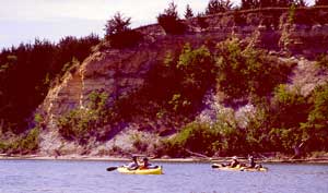
Two stretches of the Missouri River are protected, in
the South Dakota/Nebraska area. The portion originally set aside, from Gavins Point
Dam-Yankton, SD, to Ponca, Nebraska, still exhibits the river's dynamic
character in its islands, bars, chutes, and snags. The second
portion includes the land located adjacent to the free-flowing segment
between Lewis and Clark Lake and Lake Francis Case. This section
represents one of the best natural landscapes associated with the river
along its entire course. Native floodplain forest, tallgrass and mixed grass prairies, and the river provide habitats for several
endangered bird and fish species. Recreational activities include
fishing, hunting, and canoeing. The lower 20 miles of the Niobrara
River are also included.
|