|
|

|
|
|
|
Welcome to Indian Country Continued
...
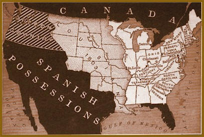
The 13 Original States
By 1790, the original 13 states were created - Connecticut, Delaware,
Georgia, Maryland, Massachusetts, New Hampshire, New Jersey, New York,
North Carolina, Pennsylvania, Rhode Island, South Carolina and Virginia.
Shortly thereafter, Kentucky, Tennessee and Vermont became states.
And by 1803, at the start of the Lewis and Clark Journey, Ohio became
the 17th state in the new union.
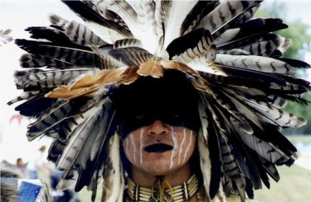
Lewis and Clark Were Informed of or
Encountered 100 + Tribes
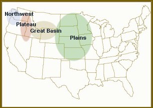
GREAT BASIN INDIANS: Shoshone, Bannock, Pauite
Known as Digger Indians; foraging and digging for edible
wild plants - roots, berries, seeds, and nuts. PLAINS
INDIANS: Blackfeet, Assiniboine, Crow,
Hidatsa, Mandan,
Yankton Sioux, Arikara, Teton Sioux, Ponca, Omaha,
Otoe, Kaw,
Missouri, Osage
Nomadic lifestyle following the buffalo herds. Most famous
of all Indians for their horsemanship, buffalo hunting skills,
teepees, and war bonnets.
PLATEAU INDIAN: Yakama, Umatilla, Walla Walla, Nez Perce, Flathead, Wishram,
Wanapum, Palouse, Cayuse, Klickitat, Methow.
Living along the Columbia River Basin and its tributaries, the Plateau Indians
were skillful fisherman. Salmon was their main food source; supplemented
with a variety of berries and roots.
NORTHWEST COASTAL INDIANS: Chinook, Tillamook, Clatsop,
Salishan.
Were among the premier Native American woodworkers.
Northwest Coastal Indians often erected giant totem poles
outside their houses.
Resource Links to Learn More About Lewis and Clark & Native
Culture
Along the Lower Missouri - First Native Council

On May 21, 1804 "The Corps of Discovery" set out on one of
the most documented American adventures. By July,
the
Corps had
traveled into Indian country, but had not met up with any
Indians. Then, during a halt a
hunting
party met up with a Missouri Indian. A few days later a
company of
Otoe and Missouri came to visit. Lewis spoke to the
assemblage about the United States control of Louisiana and the
need for peace between Indians and Americans.
On the Upper Missouri - The Great
Sioux Nation
Lewis and Clark on the Great Plains Timeline
Lewis knew that he would soon run into the Sioux and they might
not receive him so cordially. Lewis finally made contact with
the
Yankton Sioux at Calumet Bluff on August 30th. He saw little of
the ferocity of the Sioux in this first meeting, and the expedition
parted from the Yanktons' on the best of terms.
For a while, the Corps spent some idyllic days hunting the
abundant autumn game, while Lewis was happily engrossed with natural
history. This mood was shattered by the keelboat's
approach to another Sioux camp, which turned out to be far from
peaceable. When Lewis tried to begin a council, the chiefs reacted
with suspicion and belligerence. The
Teton Sioux did not want a powerful force of white men so deep
within their country. But again the explorers combination of
coolness and firepower kept the Indians from starting a fight. As a
result, peace had been preserved, and the Corps of Discovery sailed
on. Proceeding up the Missouri, the Corps of Discovery receive a
peaceful reception from an Arikara village and rest.
York, Clark's slave, astounded the Arikara's with his size and
skin color. Captain Clark's journal entry, October 10, 1804,
"The Indians much asstonished at my Black servent and Call him the
big medison, this nation never saw a black man before."
Winter at Fort Mandan- Among the Mandan
Villages
Because the weather had turned cold, windy, and wet, a winter
campsite was urgently needed. One was found near the
Mandan Villages in present day North Dakota by the time of the
first snow, and its construction was begun in November. A stout log
fort called
Fort Mandan was completed by December 24th, 1804, and
the Corps settled in for the winter. While at Fort Mandan, Lewis
made contact with fur traders, one of them was a French Trader
Touissant Charbonneau that was married to a
Shoshone girl named
Sacagawea, who would later be helpful to the
expedition. When spring freed the keelboat from river ice,
Lewis sent it back east with some of the soldiers
and many of the new discoveries. The narrowing river demanded
smaller craft, and so the Corps made six canoes to supplement the
two pirogues.
Across the Mountains
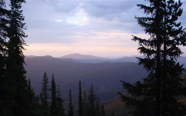
Lewis and Clark had been shocked to find that the Rockies were
not a single wall of mountains. They still believed that the
Columbia headwaters would be waiting for them after a short
overland trek across the Continental or Great Divide. By July 25th,
they had reached another expected landmark, the
Missouri's Three Forks. Lewis and a few men
left the party to forge ahead on land and look for the Shoshoni.
They roamed the river valley for days while Clark and the others
dragged the boats up the stream. Lewis knew the need for Indian
help grew even more desperate. Without horses the "Corps of
Discovery" would not be able to continue. The day after crossing
the Divide, Lewis met a band of Shoshoni and sent for Clark and
the rest of the company. When they arrived, it was discovered
that the leader of the Shoshoni band was
Sacagawea's brother. This family connection
helped the Corps acquired horses, information and a guide. They
cached
their canoes and some equipment on the newly named
Jefferson River, and then struggled off on heavily laden horses
over underbrush choked mountain trails looking for navigable
water. In
September, they decided to turn north to the Bitterroot
Valley in order to strike an
Indian trail
described by the Shoshoni. The trail was rocky and
horses crippled themselves and some even fell off the slopes.
The hunting was poor and the men hungry. They soon found before
them lower, less rugged terrain, and a creek which they were
sure would lead to the Columbia River. A headlong descent by the
starving, weakened men brought them to a hospitable
Nez Perce camp, where the Indians fed them with dried
salmon. Here the weather was warmer and the game more plentiful.
After they had been fed and had rested, the Corps began to
travel again. Within a few days they had reached the Clearwater
River, a tributary of the Snake which led to the Columbia.
Ocean in View ~ O' the Joy!
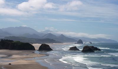
Within a few days, the river widened into a broad bay.
The Corps thought (mistakenly) that they could see the
Pacific. Clark wrote
"Ocian in view! O, the joy!", but that
joy turned to misery when rough water and torrential rain
drove them to camp under the bays sheer cliffs. After a few
days they paddled into the Columbia's estuary, with the open
sea spread before them. Later while a spot for a
winter camp was being
voted on, Clark carved on a
tree: "William Clark, By land from the U. States
in 1804 and 1805."
Departing Fort Clatsop
Leaving
Fort Clatsop, Oregon on March 23,
1806, the Corps of Discovery began their journey home.
Having survived a winter of sickness, monotonous diet,
and dreary weather, the impatient explorers departed
after gifting Fort Clatsop to a
Clatsop leader. It had been
almost two years since they had left Wood River,
Illinois in May of 1804. The explorers were
backtracking across familiar terrain and their previous
route, however they would alter their path after passing
the
great falls of the Columbia.
Trading canoes for horses the explorers continued their
journey by land to the
Walla Walla (Walula) Indians.
Camping among the tribe for two days, Chief Yelleppit
informed them of an overland shortcut to the Nez Perce.
This route took the party across present towns of
Waitsburg, Dayton, and Pomeroy,
Washington.
Reaching the Snake River on May 4, they
continued traveling up the north side of the river
before settling into a camp on May 14, awaiting the
snows to melt in the Bitterroot Mountains. Their
campsite was called "Camp Chopunnish",
a word Lewis used for the Nez Perce, located near
Kamiah, Idaho.
On
June 10,
they gathered their horses and proceeded
on to Weippe Prairie. Four days later Lewis
reported in his journal, "we have now been detained near
five weeks in consequence of the snows; a serious loss
of time at this delightfull season for traveling. Every
body seems anxious to be in motion." The next
morning they departed Weippe Prairie in an attempt to
cross
Lolo Trail. On June 17 the
disappointed explorers returned to the Prairie and hired
an Indian guide from their nearby campsite of "Chopunnish".
On June 24 the party set out along with their three Nez
Perce guides arriving at
Traveler's Rest (near present
Missoula, Montana) six days later.
On July 3, 1806, the Corps of Discovery left
Travelers' Rest.
Captain Lewis and nine men went to pursue a direct
route to the Missouri, then explore Maria's river.
Captain Clark and the rest of the party went a new
route to the Jefferson River, then descended to the
Three Forks and then proceeded with a detachment party
to explore the Yellowstone, while Sergeant Ordway, with
nine men, descended the Missouri.
Map of Routes
Reuniting on August 12, at
Reunion Bay near New Town, North Dakota,
days later Lewis and Clark bid farewell to
Sacagawea,
paid Toussaint Charbonneau for his services and turned
their canoes south, arriving in
St. Louis 37 days later.
|
|
|